Clachtoll Beach Campsite is a quiet family run touring caravan and camping site in Sutherland, in the North West of Scotland, 5 miles North of the village of Lochinver. The campsite covers an area of approximately 2.5 acres and is entirely grass. On arrival visitors are asked to report to the Wardens who will help them to find a suitable site.
We now have 20 serviced pitches which provide water and Electric hook-ups + to avoid disappointment we now take bookings for our busy times.
Toilet and shower facilities, dishwashing sinks, laundry, chemical disposal point and a public telephone are available. Dogs are welcome provided they are kept on a lead at all times on the campsite.
This area is renowned for its outstanding natural beauty and spectacular land and seascapes
Lochinver provides a good range of services and facilities and is the nearest place for petrol/diesel and food provisions. There is also a bank, post office, newsagent, hardware supplies, tourist information centre and various other shops.
Clachtoll Beach Campsite and the surrounding area offers something for everyone, whether you want an action packed day or a leisurely day, reading a book or relaxing on the beach.
Facilities
Excellent toilet and shower facilities, dishwashing sinks, laundry, chemical disposal point, electric hook-ups, hot drinks vending machine, free Wi-Fi and a public telephone are available.
Walking & Fishing
Clachtoll and the surrounding area offers excellent opportunities for walking and fishing. There are many other activities too, so check with the local Tourist Information office to find out what is on offer.
Walking
Enjoy coastal walks along the beaches and cliff tops or explore inland and follow some of the old peat roads through the hills, moors and by lochs.
Clachtoll and the surrounding area offers excellent opportunities for walking and fishing. There are many other activities too, so check with the local Tourist Information office to find out what is on offer.
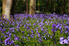
There are also some wonderful woodland walks. Try Culag Woods in Lochinver where a network of paths through the woods will lead you to make some surprising discoveries. Try the Scultpure Trail, the 'Orien TREEing Trail' or the 'Are You Brave Enough Trail'! Culag woods are also home to one of the largest colonies of herons in the Highlands.
If you are looking to scale some heights then there are some magnificent mountains to tackle in the area; Quinag, Canisp, Suilven, Cul Mor and Ben More Assynt to name but a few.
Fishing
River, loch or sea, there is an abundance of choice when it comes to fishing in the area.
There are over 200 lochs to fish, some have salmon and sea trout runs, and most contain wild brown trout and sometimes char. On some lochs it is possible to hire a boat.
Fishing permits are required for lochs and rivers but are reasonably priced and are available from various shops and post offices in the area as well as from the Assynt Visitor Centre where the Tourist Information is located in Lochinver.
History
There are so many places of historical interest in the Assynt area, below is a list of just a few. Visit the Assynt Visitor Centre in Lochinver to find out more about them.
Am Bearag -Salmon Fishers Bothy
Perched above the shore, between the rocky bay and the sandy bay at Clachtoll, next to the Norman Macleod Memorial is the Salmon Bothy,
ice house and net drying poles, where Clachtoll Salmon Netting Station was based until it's closure in 1994. It was the last salmon netting station on the west coast to close.
Migrating salmon returning to the rivers Inver and Kirkaig were caught in nets which were set out along the coast by the fishermen from Clachtoll.
In it's heyday more than 100 salmon per day were netted, the season was from February 5th - August 20th.
Today, Comunn Eachdraidh Asainte (Assynt Historical Society) are involved in a project to restore the bothy and ice house
so that locals and visitors to the area can learn about the important part it played in the history of the area.
This project is almost fully completed and you can find information and displays in both the bothy and the ice house.
The Rev. Norman MacLeod
Born on 29th September 1780 in Clachtoll to a crofting and fishing family, Norman MacLeod made his name as a preacher.
He studied at Aberdeen and Edinburgh Universities and in 1815 took up a teaching post at the school in Ullapool.
His open defiance of the established church caused him to lose his teaching position, however, he gathered his own following of worshippers and after a brief stint as a herring fisher in Wick,
he left Scotland and emigrated to Canada in 1817 along with many of his followers. His family joined him a year later.
After more than 30 years in Canada at Pictou and St Annes, MacLeod and his followers set sail from St Helens in 1851 heading for Australia.
Two years of hardship followed and an outbreak of typhoid swept through the temporary community in Melbourne set up by MacLeod,
claiming the lives of many of his followers including three of his own sons.
In 1853, MacLeod left Australia and sailed to Auckland, New Zealand where he settled in Waipu.
He was joined by over 800 'Normanites' (as his followers came to be know) who arrived from Cape Bretton.
MacLeod remained in Waipu where he died from a fever on 14th March 1886.
A memorial stone to the memory of the Reverend Norman MacLeod sits above the rocky bay at Clachtoll.
Clachtoll Broch
A short walk northwards along the coast from the campsite you will find the remains of an Iron Age Broch (fort).
Built around 2000 years ago it was one of some 500 brochs scattered around the North West of Scotland.
A massive dry stone construction with a double wall and stairway between the walls, there were no windows and only one entrance.
Originally it would have stood 27 feet (9m) high. Although now a ruin, visitors can still see the entrance and the construction of the double walls.
Altan na Bradhan
If you are walking along the coast to the south of Clachtoll you may find the ruins of Altan na Bradhan Meal Mill with the mill stones still at the site.
It is a reminder of the days when the area was more heavily populated and the people relied on their living from the proceeds of the land and the sea.
Ardvreck Castle
On the shores of Loch Assynt stand the ruins of Ardvreck Castle and Calda House. The castle, stronghold of the MacLeods of Assynt, was built around 1597.
Calda House dates from about 1726 and was built by the MacKenzies who following a siege in 1672 had seized Ardvreck Castle from the MacLeods.
Smoo Cave
Smoo Cave is located at the village of Durness, on Scotland's most northerly coastline. Set into limestone cliffs, Smoo Cave is approximately 200 feet long, 130 feet wide, and 50 feet high at the entrance. The cave is a great tourist attraction and is well worth a visit.
Nature & Geology
The area surrounding Clachtoll Beach Campsite includes a variety of different habitats.
Travelling around the Assynt area you will notice the landscape is diverse and varied; moorland, lochs, bogs, mountains, woodland, sea cliffs, machair, rocky beaches and of course, sandy beaches such as the one at Clachtoll.
Wildlife
With such a variety of habitat, it's no surprise that the area boasts a wealth of wildlife and marine life, plants and flowers. Schools of dolphin have regularly been spotted from the campsite as they pass along the coast, as have porpoise, basking sharks and minke whales. Seals and otters are also seen regularly playing around the coast.
Land and sea birds are in abundance and the woodlands in the area are home to badgers, deer and pine martins.
The Ranger's Hut situated in the beach car park at Clachtoll has display boards with information about the area and some of the things you might expect to see during your visit.
The Highland Council Rangers lead guided walks to places of interest throughout the summer season so be sure and pick up a leaflet to find out what they will be doing during your stay.
Geology
This area also boasts some of the most unique and oldest geology in Britain and in some cases Europe; sandstone, quartz, dolomite, limestone and Lewisian Gneiss all play a part in the makeup of the landscape. Lewisian Gneiss is the oldest type of rock found in the area at about 3 billion years old!!! The last ice age, 10,000 years ago shaped the landscape into the way it looks today.
The Moine Thrust runs from Durness to the south of Skye and was formed some 400-440 million years ago when Scandinavia collided with Greenland (which was attached to Scotland at that time). For the next 20-40 million years they continued to move at approx. 10 cm a year and formed what is considered to be one of the most famous thrusts in the world, the Moine Thrust, part of which can be seen at Unapool and Knockan Crag. Look out for information panels at various laybys in the area which will explain the view you are looking at and how it was created.